The National Parks of Great Britan
Coastline
Exmoor has 34 miles (55 km) of coastline, including the highest cliffs in England, which reach a height of 1,350 feet (411 m) at Culbone Hill. However, the crest of this coastal ridge of hills is more than a mile (1.6 km) from the sea. If a cliff is defined as having a slope greater than 60 degrees, the highest cliff on mainland Britain is Great Hangman near Combe Martin at 1,043 feet (318 m) high, with a cliff face of 800 feet (244 m). Its sister cliff is the 716 feet (218 m) Little Hangman, which marks the edge of Exmoor.
Exmoor’s woodlands sometimes reach the shoreline, especially between Porlock and The Foreland, where they form the single longest stretch of coastal woodland in England and Wales. The Exmoor Coastal Heaths have been recognised as a Site of Special Scientific Interest due to the diversity of plant species present.
The scenery of rocky headlands, ravines, waterfalls and towering cliffs gained the Exmoor coast recognition as a Heritage Coast in 1991. With its huge waterfalls and caves, this dramatic coastline has become an adventure playground for both climbers and for explorers. The cliffs provide one of the longest and most isolated seacliff traverses in the UK. The South West Coast Path, at 630 miles (1,014 km) the longest National Trail in England and Wales, starts at Minehead and runs along all of Exmoor’s coast. There are small harbours at Lynmouth, Porlock Weir, and Combe Martin. Once crucial to coastal trade, the harbours are now primarily used for pleasure; individually owned sail boats and non-commercial fishing boats are often found in the harbours
Flora
Dunkery Beacon, with heather in bloom
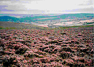
Uncultivated heath and moorland cover about a quarter of Exmoor landscape. Some moors are covered by a variety of grasses and sedges, while others are dominated by heather. There are also cultivated areas including the Brendon Hills, which lie in the east of the National Park. There are also 32.4 square miles (84 km2) of woodland, comprising a mixture of broad-leaved (oak, ash and hazel) and conifer trees. Horner Woodlands and Tarr Steps woodlands are prime examples. The country’s highest beech wood, 1, 200 feet (366 m) above sea level, is at Birch Cleave at Simonsbath. At least two species of whitebeam tree: Sorbus subcuneata and Sorbus ‘Taxon D’ are unique to Exmoor. These woodlands are home to lichens, mosses and ferns. Exmoor is the only national location for the lichens Biatoridium delitescens, Rinodina fimbriata and Rinodina flavosoralifera, the latter having been found only on one individual tree.
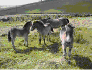
A herd of Exmoor pony foals
Sheep have grazed on the moors for more than 3,000 years, shaping much of the Exmoor landscape by feeding on moorland grasses and heather. Traditional breeds include Exmoor Horn, Cheviot and Whiteface Dartmoor and Greyface Dartmoor sheep. Devon ruby red cattle are also farmed in the area. Exmoor ponies can be seen roaming freely on the moors. They are a landrace rather than a breed of pony, and may be the closest breed to Equus ferus remaining in Europe. The ponies are rounded up once a year to be marked and checked over. In 1818 Sir Richard Acland, the last warden of Exmoor, took thirty ponies and established the Acland Herd, now known as the Anchor Herd, whose direct descendants still roam the moor. In the Second World War the moor became a training ground, and the breed was nearly killed off, with only 50 ponies surviving the war. The ponies are classified as endangered by the Rare Breeds Survival Trust, with only 390 breeding females left in the UK. In 2006 a Rural Enterprise Grant, administered locally by the South West Rural Development Service, was obtained to create a new Exmoor Pony Centre at Ashwick, at a disused farm with 17 acres (6.9 ha) of land with a further 138 acres (56 ha) of moorland.
Red deer have a stronghold on the moor and can be seen on quiet hillsides in remote areas, particularly in the early morning. The moorland habitat is also home to hundreds of species of birds and insects. Birds seen on the moor include Merlin, Peregrine Falcon, Eurasian Curlew, European Stonechat, Dipper, Dartford Warbler and Ring Ouzel. Black Grouse and Red Grouse are now extinct on Exmoor, probably as a result of a reduction in habitat management, and for the former species, an increase in visitor pressure.
Beast of Exmoor
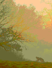
The Beast of Exmoor is a cryptozoological cat (see phantom cat) that is reported to roam Exmoor. There have been numerous reports of eyewitness sightings, however the official Exmoor National Park website lists the beast under “Traditions, Folklore, and Legends”,and the BBC calls it “the famous-yet-elusive beast of Exmoor. Allegedly." Sightings were first reported in the 1970s, although it became notorious in 1983, when a South Molton farmer claimed to have lost over 100 sheep in the space of three months, all of them apparently killed by violent throat injuries. It is reported as being between 4 and 8 feet (1.2 and 2.4 m) from nose to tail. Descriptions of its colouration range from black to tan or dark grey. It is possibly a Cougar or Black Leopard which was released after a law was passed in 1976 making it illegal for them to be kept in captivity outside zoos. In 2006, the British Big Cats Society reported that a skull found by a Devon farmer was that of a Puma, however, the Department for Environment, Food and Rural Affairs (Defra) states, “Based on the evidence, Defra does not believe that there are big cats living in the wild in England. ”
Places of interest
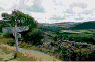
The attractions of Exmoor include 208 scheduled ancient monuments, 16 conservation areas, and other open access land as designated by the Countryside and Rights of Way Act 2000. Exmoor receives approximately 1.4 million visitor days per year. Many come to walk on the moors or along waymarked paths such as the Coleridge Way. Attractions on the coast include the Lynton and Lynmouth Cliff Railway, which connects Lynton to neighbouring Lynmouth, where the East and West Lyn River meet. Woody Bay, a few miles west of Lynton, is home to the Lynton & Barnstaple Railway, a narrow gauge railway which connected the twin towns of Lynton and Lynmouth to Barnstaple,20 miles (32 km) away. Further along the coast, Porlock is a quiet coastal town with an adjacent salt marsh nature reserve and a harbour at nearby Porlock Weir. Watchet is a historic harbour town with a marina and is home to a carnival, which is held annually in July.
Inland, many of the attractions are centred around small towns and villages or linked to the river valleys, such as the ancient clapper bridge at Tarr Steps and the Snowdrop Valley near Wheddon Cross, which is carpeted in snowdrops in Februaryand, later, displays bluebells. Withypool is also in the Barle Valley. The Two Moors Way passes through the village. As well as Dunster Castle, Dunster’s other attractions include a priory, dovecote, yarn market, inn, packhorse bridge, mill and a stop on the West Somerset Railway. Exford, lies on the River Exe. Brendon, in the Brendon Valley is noted for the annual Exmoor folk festival.
Exmoor has been the setting for several novels including the 19th-century Lorna Doone: A Romance of Exmoor by Richard Doddridge Blackmore, and Margaret Drabble’s 1998 novel The Witch of Exmoor. The park was featured on the television programme Seven Natural Wonders twice, as one of the wonders of the West Country.
8. Yorkshire DalesThe Yorkshire Dales (also known as The Dales) is the name given to an upland area, in Northern England.
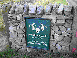
The area lies within the historic county boundaries of Yorkshire, though it spans the ceremonial counties of North Yorkshire, West Yorkshire, and Cumbria. Most of the area falls within the Yorkshire Dales District National Park, created in 1954, and now one of the twelve National parks of England and Wales (not including the South Downs which is due to become one).
The Dales is a collection of river valleys and the hills in between them, rising from the Vale of York westwards to the hilltops of the main Pennine watershed (the British English meaning). In some places the area even extends westwards across the watershed, but most of the valleys drain eastwards to the Vale of York-into the Ouse and then the Humber.
The word dale comes from a Nordic/Germanic word for valley, and occurs in valley names across Yorkshire (and northern England generally) but since the creation of the Yorkshire Dales National park, the name Yorkshire Dales has come to refer specifically to these western dales and the area of dales and hills east of the Vale of York is now called the North York Moors after the National Park created there
Yorkshire Dales National Park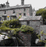
In 1954 an area of 1,770 square kilometres (680 sq mi) was designated the Yorkshire Dales National Park. Most of the National Park is in North Yorkshire, though part lies within Cumbria. However, the whole park lies within the traditional boundaries of Yorkshire, divided between the North Riding and the West Riding. The park is 50 miles (80 km) north east of Manchester; Leeds and Bradford lie to the south, while Kendal is to the west and Darlington to the east.
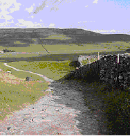
Over 20,000 residents live and work in the park, which attracts over eight million visitors every year. The area has a large collection of activities for visitors. For example, many people come to the “Dales” for walking or exercise. The National Park is crossed by several long-distance routes including the Pennine Way, the Dales Way, the Coast to Coast Path and the latest national trail - the Pennine Bridleway. Cycling is also popular and there are several cycleways.
The Park has its own museum, the Dales Countryside Museum, housed in a conversion of the Hawes railway station in Wensleydale in the north of the Park. The park has 5 visitor centres located in major destinations in the park. These are at:
Geography
Most of the dales in the Yorkshire Dales are named after their river or stream (eg Arkengarthdale, formed by Arkle Beck). The best-known exception to this rule is Wensleydale, which is named after the town of Wensley rather than the River Ure, although an older name for the dale is Yoredale. In fact, valleys all over Yorkshire are called “ (name of river) +dale”-but only the more northern Yorkshire valleys (and only the upper, rural, reaches) are included in the term “The Dales". For example, the southern boundary area lies in Wharfedale and Airedale. The lower reaches of these valleys are not usually included in the area, and Calderdale much further south, would never normally be referred to as part of “The Dales" even though it is a dale, is in Yorkshire, and the upper reaches are as scenic and rural as many valleys further north.
Geographically, the classical Yorkshire Dales spread to the north from the market and spa towns of Settle, Deepdale near Dent, Skipton, Ilkley and Harrogate in North Yorkshire, with most of the larger southern dales (e. g. Ribblesdale, Malhamdale and Airedale, Wharfedale and Nidderdale) running roughly parallel from north to south. The more northerly dales (e. g. Wensleydale, Swaledale and Teesdale) running generally from west to east. There are also many other smaller or lesser known dales (e. g. Arkengarthdale, Barbondale, Bishopdale, Clapdale, Coverdale, Dentdale and Deepdale, Garsdale, Kingsdale, Littondale, Langstrothdale, Raydale, Waldendale and the Washburn Valley) whose tributary streams and rivers feed into the larger valleys. [1]
The characteristic scenery of the “Dales” is green upland pastures separated by dry-stone walls and grazed by sheep and cattle. The dales themselves are ‘U’ and ‘V’ shaped valleys, which were enlarged and shaped by glaciers, mainly in the most recent, Devensian ice age. The underlying rock is principally Carboniferous limestone (which results in a number of areas of limestone pavement) in places interspersed with shale and sandstone and topped with millstone grit. However, to the north of the Dent fault, the hills are principally older Silurian and Ordovician rocks, which make up the Howgill Fells.
Many of the upland areas consist of heather moorland, used for grouse shooting in the months following 12 August each year (the ‘Glorious Twelfth’).
Cave systems
Gaping Gill
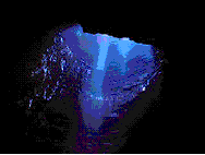
Because of the limestone that runs throughout the “Dales” there are extensive cave systems present across the area making it one of the major areas for caving in the UK. Many of these are open to the public for tours and for caving.
9. Lake District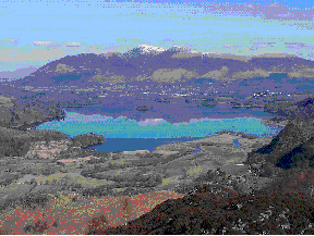
The Lake District, also known as The Lakes or Lakeland, is a rural area in North West England. A popular holiday destination, it is famous for its lakes and its mountains (or fells), and its associations with the early 19th century poetry and writings of William Wordsworth and the Lake Poets.
The central and most-visited part of the area is contained in the Lake District National Park, one of fourteen National Parks in the United Kingdom. It lies entirely within Cumbria, and is one of England's few mountainous regions. All the land in England higher than three thousand feet above sea level lies within the National Park, including Scafell Pike, the highest mountain in England
General geography
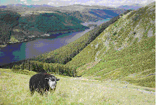
The Lake District is approximately 34 miles (55 km) across. Its features are